Services and Technology
Three service lines and the instruments behind them, designed and built in Lahore. Engage one, or run the full chain as a study, a project or a retainer.
Discuss a requirementThree Service Lines
Engage one or run the full chain, as a study, a project or a retainer.
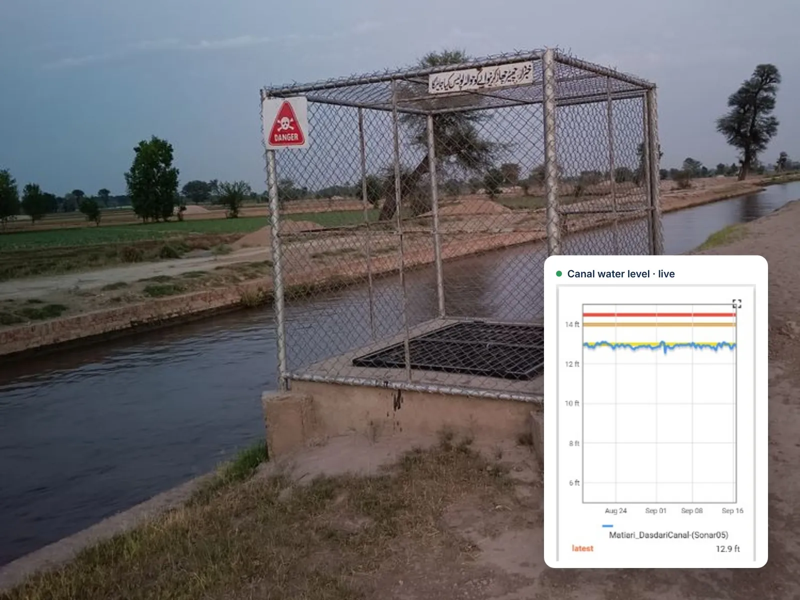
01 xWIT
Monitoring
Field instrumentation for water level, flow, weather, soil moisture and quality, with telemetry built around your reporting cycle.
- Site survey and network design
- Installation and calibration
- Telemetry and data logging
- Live dashboard and alerting
- Maintenance schedule
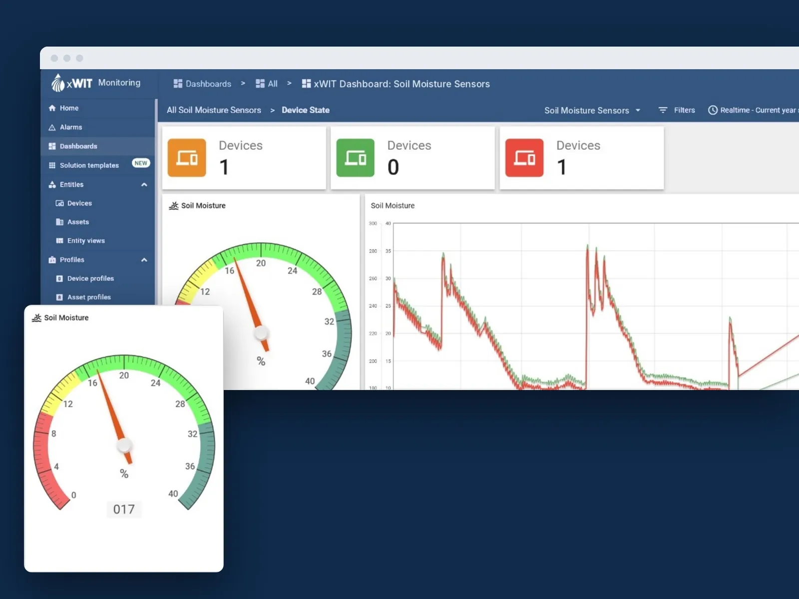
02 xWIT
Analytics
Hydrological and climate modelling, remote sensing and forecasting that convert measurement into scenarios you can plan against.
- Water balance models
- Remote sensing analysis
- Flood and drought scenarios
- Seasonal forecasting
- Risk and exposure mapping
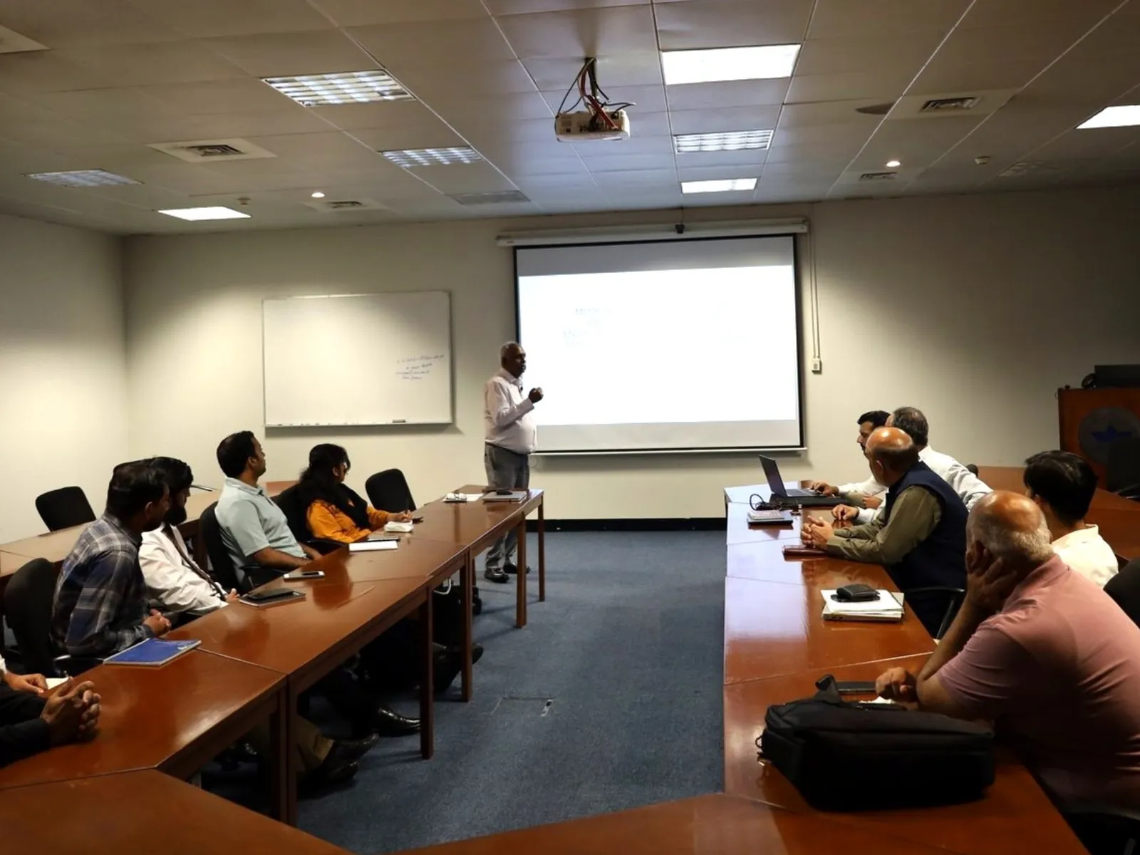
03 xWIT
Advisory
Regulatory strategy, feasibility work, independent review and hands on training so your team can run what we hand over.
- Environmental due diligence
- Feasibility and options studies
- Regulatory strategy
- Independent technical review
- Operator training
Built on one hardware platform
Every field device we build shares the same connectivity, power and enclosure design, so a network can mix instruments without mixing suppliers.
WaterSense, SmartAWD, Miqyas and Mizan each come in all four variants, for example WaterSense-GS or Mizan-LB. The weather station comes as AWS-GS or AWS-LS.
Technologies developed with the Centre for Water Informatics and Technology (WIT) at LUMS.
Water and irrigation
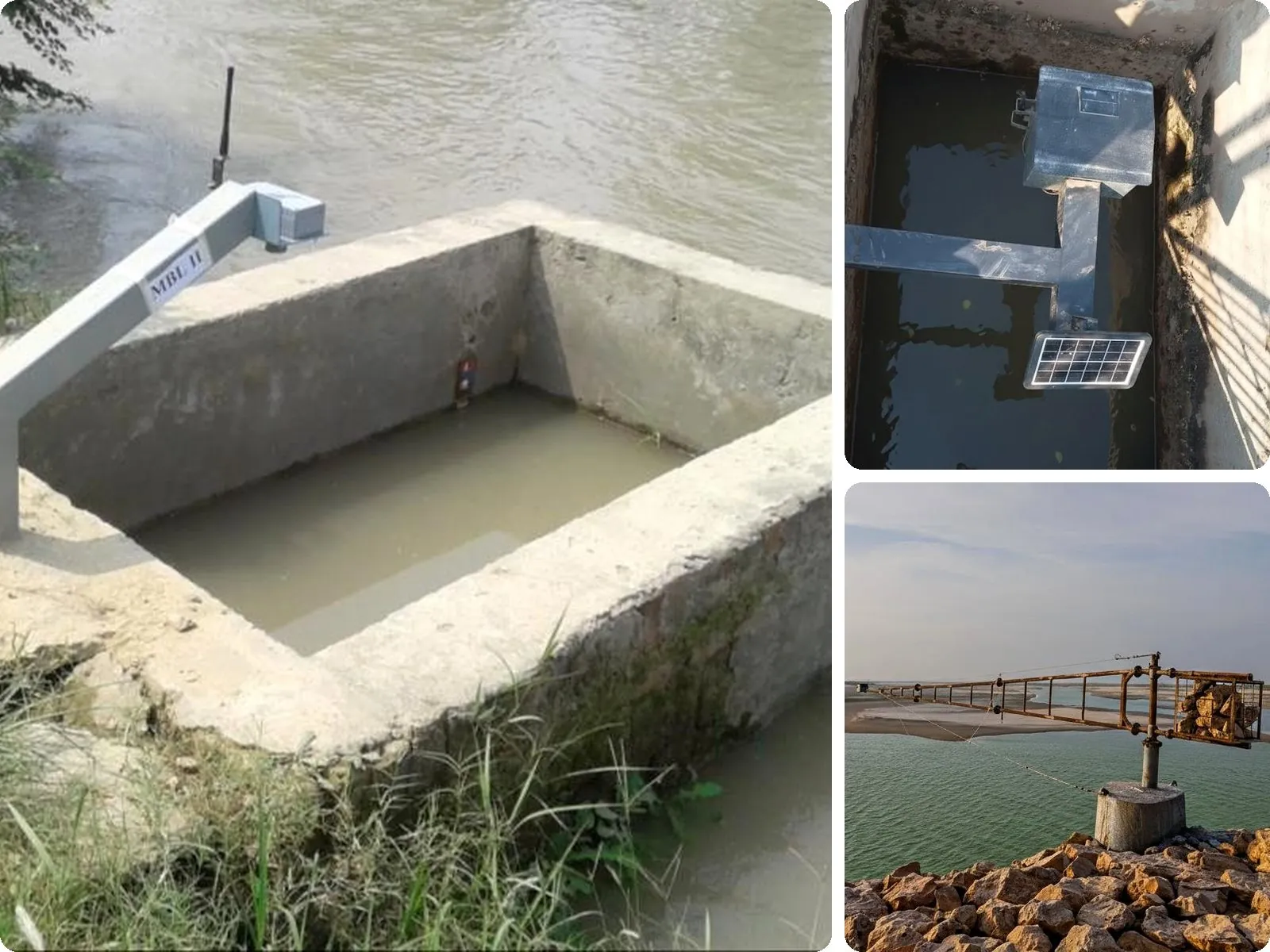
CG-100 Miqyas Digital Canal Gauge
A low cost, non contact gauge for real time monitoring of canal levels and hydraulic head, replacing manual gauge readings with high precision telemetry.
- Depth measurement up to 10 metres
- Add-on weather sensors for temperature, humidity and rainfall
- Low cost, built for canal networks
- Long battery life for intervention free operation
- Remote connectivity over GSM or LoRaWAN
| Technology | Dual non contact ultrasonic transducers with active temperature compensation |
| Range | 0.3 m to 10 m |
| Accuracy | 1 mm resolution; ±3 mm accuracy |
| Enclosure | IP67 enclosure (6 × 3 × 2.5 in) inside a powder-coated steel protection box (9 × 6 × 6 in) |
| Variants | Miqyas-GB, -GS, -LB, -LS |
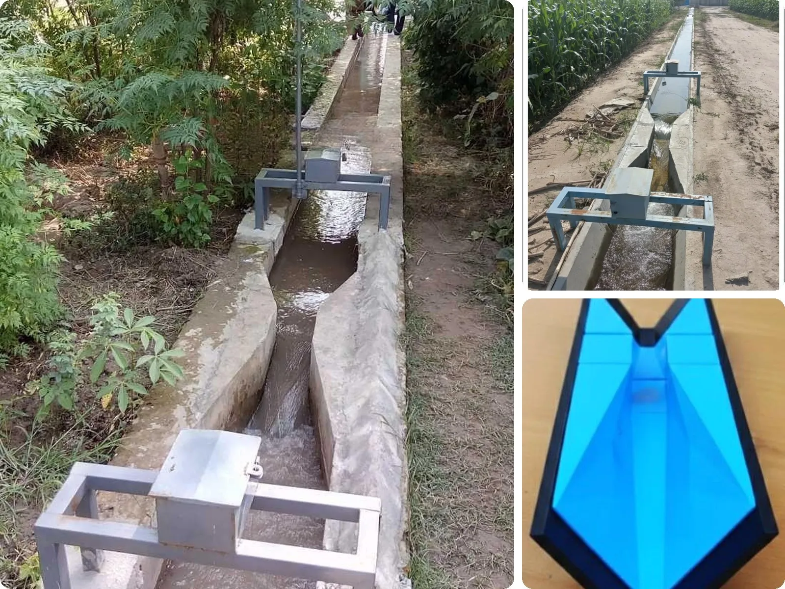
Mizan Smart Water Flume
Automated discharge measurement. Dual level sensing combined with standard flume geometries gives real time flow data for equitable water distribution.
- Dual-point sensing. Upstream and downstream levels monitored together for precise flow calculation.
- Discharge automation. Real time flow (Q) from flume coefficients such as Cutthroat and Parshall.
- Submergence handling. Detects submerged flow automatically to protect data integrity.
- Realtime telemetry. Data over LoRaWAN or GSM LTE (Cat-M1).
- Long endurance. 2+ years of intervention free operation on integrated solar power.
| Technology | Two non contact ultrasonic (sonar) transducers with active temperature compensation; H1 at 2/3 of the converging length, H2 at the throat for submergence |
| Level range | 0.3 m to 10 m; 1 mm resolution, ±3 mm accuracy |
| Flow range (Q) | 10 to 400 litres per second; needs at least 50 mm of water depth |
| Channels | OFWM PCPS segments No. 3 to 9+ and rectangular masonry channels at least 300 mm wide |
| Installation | Typically 4 to 8 ft long, scaled to the segment; needs a straight approach of 10× the segment top width |
| Variants | Mizan-GB, -GS, -LB, -LS |
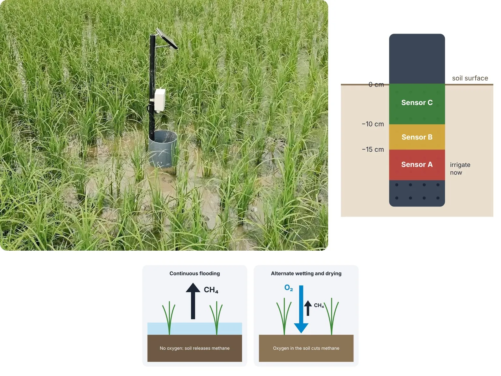
SmartAWD Tube
An IoT field tube for alternate wetting and drying in paddy fields, saving water, energy and methane emissions.
- Up to 3-point water level sensing sends the farmer a timely alert on when to irrigate
- Weatherproof enclosure
- Long battery life for intervention free operation
- Remote connectivity over GSM or LoRaWAN
- Cost effective and scalable
| Technology | Hybrid multipoint discrete capacitive/resistive sensing, optional laser ranging |
| Measurement | 3 discrete points, optional continuous ranging; adjustable from +10 cm above to −20 cm below the soil surface |
| Sensors | Stainless steel sensors at −15 cm, −10 cm and +5 cm (adjustable) |
| Tube | 2 ft high, 7-inch diameter body on a 1.0 to 2.0 m pole; 15 cm perforated section with 2 mm holes at 2-inch intervals |
| Variants | SmartAWD-GB, -GS, -LB, -LS |
Soil and crops
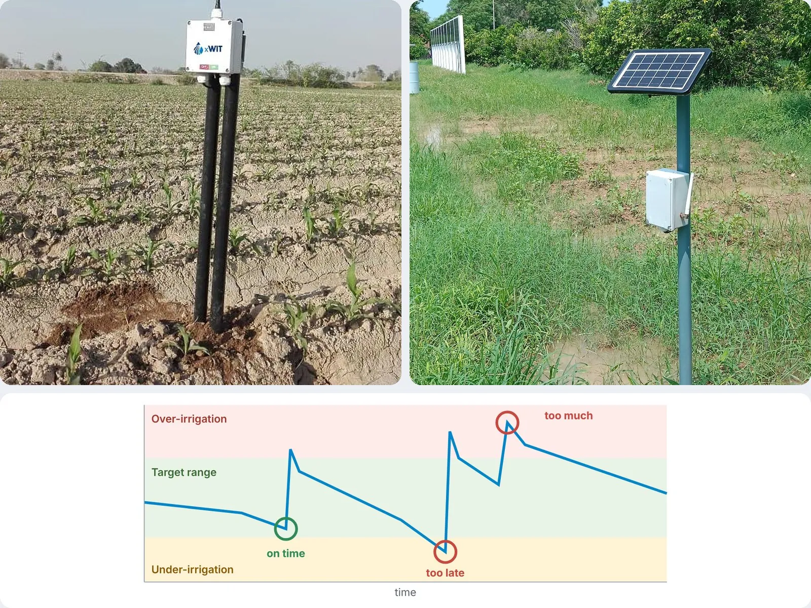
WaterSense IoT Soil Moisture Sensor
A permanently installed soil moisture sensor for smart irrigation decisions, allowing irrigation savings of up to 50%.
- Dual depth moisture monitoring
- Low cost
- Long battery life for intervention free operation
- Remote connectivity over GSM or LoRaWAN
| Technology | Dielectric permittivity / capacitive, two probes for dual depth sensing |
| Range | 0% to 100% volumetric water content (VWC) |
| Accuracy | ±3% to 5% VWC standard; ±2% with soil specific calibration |
| Sensing assembly | Two industrial-grade capacitive blades (3.5 × 0.7 × 0.3 in) with 6 ft shielded cable |
| Mounting | Compact pole-mounted enclosure on a 1.0 to 2.0 m rod |
| Variants | WaterSense-GB, -GS, -LB, -LS |
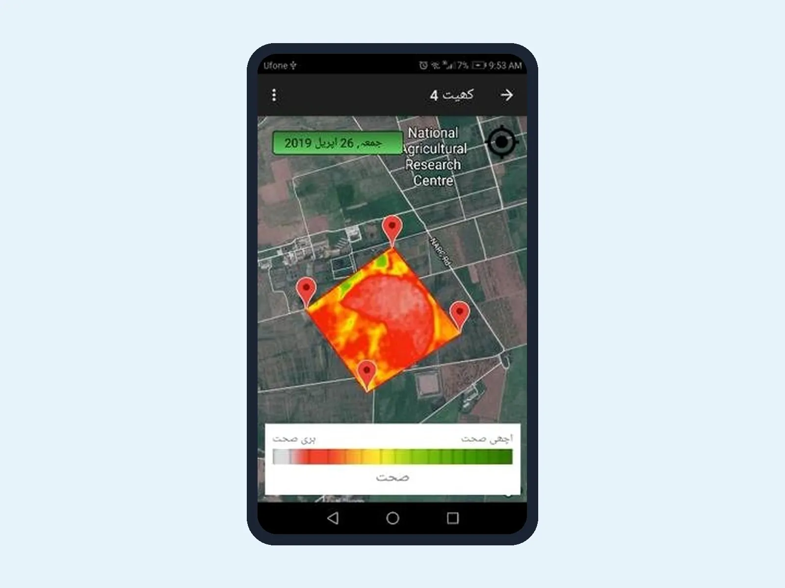
Talking Fields App
An app for sharing information with farmers and collecting data. It generates local insights from satellite imagery and on-site sensors.
- Crop health status maps (GIS)
- Integration with soil moisture sensors
- Farming guidelines in the app, with an Urdu interface
| Platform | Android app |
| Data sources | Satellite imagery and on-site sensors |
| Language | Urdu interface |
Weather and climate
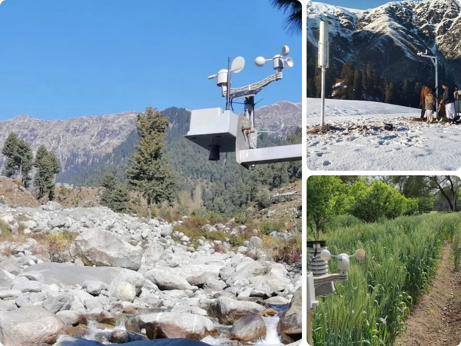
Automatic Weather Station
An all purpose weather station for climate and agricultural applications, with task specific sensor add-ons.
- Weather sensors. Temperature, humidity, rainfall, wind speed and direction.
- Climate add-ons. Snow depth, stream water level and discharge, snow and soil moisture, snow and land temperature, solar radiation.
- Connectivity. Remote connectivity over GSM or LoRaWAN.
- Power. Long battery backup with solar charging.
| Air and solar | Temperature −20 °C to 60 °C (±0.5 °C); humidity 0 to 80% RH (±3%); solar 0 to 2000 W/m² (thermopile) |
| Wind and rain | Speed and direction (360°, 22.5° resolution); rain 0.33 mm resolution, daily cumulative |
| Add-ons | Soil moisture (capacitive VWC) and ultrasonic level (0.3 m to 10 m) |
| Power | 20 W solar with a 9 Ah lead acid battery; up to 3 days of backup from one sunny afternoon |
| Variants | AWS-GS (GSM LTE) and AWS-LS (LoRaWAN AS923) |
Disaster early warning
Watch IntelliWarn in action: the mountain network and the live monitoring dashboard.
IntelliWarn
1st place, Startup Pitch Deck Competition, NDMA DEW-TE 2025A low cost, solar powered IoT flood early warning system for hard to reach communities. It detects floods in real time and raises the alarm in places with no electricity grid and no mobile signal.
- Real time flood detection. Flood sensors track water levels while community weather stations monitor rainfall.
- Alerts without power or signal. Solar nodes talk over LoRaWAN and a LoRa mesh built on the open source Meshtastic project, so village sirens and phones get the warning even off the grid.
- Works offline. Local edge servers run rules and alarms with no internet; a GSM gateway reaches the cloud and disaster response teams where coverage exists.
- Community run. Trained local residents operate and maintain the system, which keeps it running long term.
- Built for any terrain. Modular design, from mountain valleys at risk of glacial lake outburst floods (GLOFs) to plains exposed to flash floods and hill torrents.
| Sensing | Water level flood sensors; rainfall from community weather stations |
| Connectivity | LoRaWAN, LoRa mesh (Meshtastic), GSM gateway, repeaters to extend coverage |
| Alerts | Village siren nodes, mesh messages to phones, SMS through the gateway |
| Power | Solar |
| Offline operation | Local servers such as ThingsBoard Edge |
IntelliWarn was developed at the NCRA Agricultural Robotics Lab at WIT-LUMS with support from the APNIC Foundation’s ISIF Asia (Ian Peter Grant for Internet and the Environment). It won first place at the National Disaster Management Authority’s Disaster Early Warning Tech Expo 2025, themed “From Reactive to Proactive Disaster Management”.
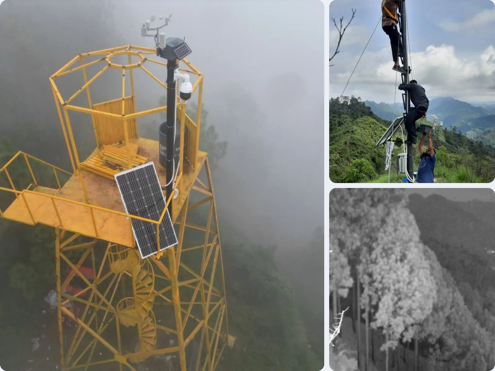
Forest Fire Early Warning System
A low cost early warning system that spots smoke and fire from watchtower cameras, confirms each event with AI, and helps response teams decide where to go.
- AIoT vision detection. Cameras on towers run AI on the device (edge) and on a central server (cloud) to confirm smoke events before raising an alert.
- Higher accuracy. A large language model pre-filters images and the custom model marks the fire, reaching 97% accuracy.
- Fire spread prediction. Hourly spread maps built on fuel models from field surveys, wind and weather data.
- Route planning. Fastest access routes for response teams, updated as the fire grows.
- Weather at the towers. IoT weather stations report conditions from the same sites.
| Detection | PTZ cameras with edge AI and cloud AI confirmation |
| Dashboards | Central map, visual inspector and fire hotspot views |
| Deployments | Forest fire detection watchtowers in the Murree and Kahuta forest divisions |
Forests
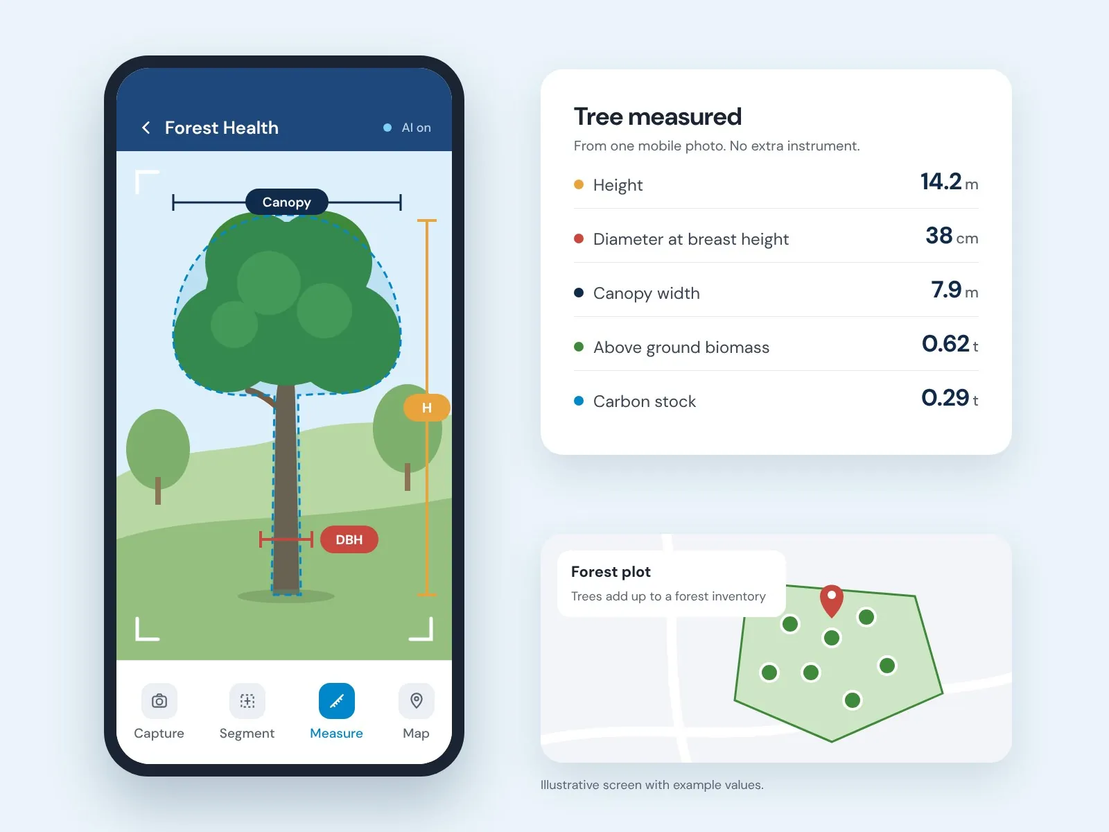
Illustrative app screen with example values.
Forest Health Monitoring App
An app that makes it easy to assess the biomass and carbon content of a single tree, and ultimately of a whole forest area.
- AI based tree identification, segmentation and height estimation
- Easy cropping of the target tree image
- Height and width measurement of trees from mobile camera imagery
- Cloud computing and data storage
| AI functions | Tree identification, segmentation and height estimation |
| Measurement | Height and diameter at breast height from the mobile camera |
| Method | Distance method on mobile camera imagery |
| Coverage | A single tree up to a whole forest area |
| Cloud | Aggregate forest inventory with biomass and carbon estimates |
AI vision
All Purpose AI Camera
An IoT camera with onboard edge computing that adapts to different monitoring jobs. Built as a low power option for remote sites where bandwidth and mains power are both scarce.
- Edge computing. Onboard AI analyses each image and sends a compact summary, so it works over a low bandwidth connection.
- Telemetry. Cloud connectivity through GSM allows deployment at remote locations.
- Weatherproof enclosure. IP67 rated against water and dust ingress for all weather operation.
- Solar charging. Solar rechargeable battery with efficient power management for long endurance without site visits.
| Edge computing | Onboard AI compresses data for low bandwidth transmission |
| Connectivity | GSM cloud connectivity for remote deployment |
| Power | Solar rechargeable with power management |
| Enclosure | IP67, all weather operation |
| Applications | Trash and debris in water channels, biodiversity in forests, crop pests, perimeter and traffic monitoring, off-grid environmental sites |
Platform
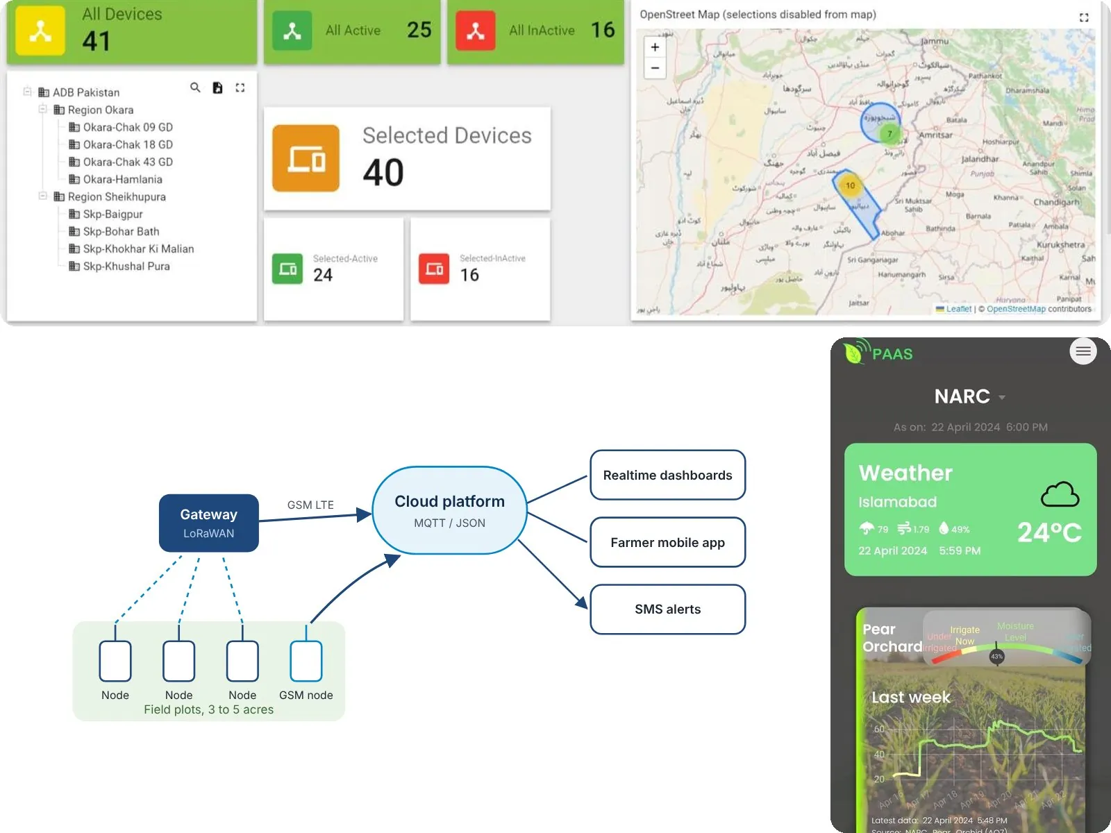
Dashboards, app and alerts
Every device reports to the same cloud platform, so farms, canal operators and programme teams see their whole network in one place.
- Realtime cloud dashboards. Live status of every device, grouped by region and site, with active and inactive counts on a map.
- Farmer mobile app. Weather and soil moisture for each plot, with a clear irrigate or hold signal.
- SMS alerts. Irrigation and threshold alerts that reach farmers on any phone.
- Flexible connectivity. Cost and infrastructure optimised: LoRaWAN gateways for clusters of nodes, direct GSM for isolated sites.
Applied Programmes
Field programmes designed, installed and run beyond the standard instrument range. Each can be scoped as a study, a project or a monitoring retainer.
WhereGabin Jabba, Swat
Snow Melt Monitoring for Flood Forecasting
A high altitude catchment at Gabin Jabba in Swat, instrumented at two elevations. The upper station reports snow depth, melt rate, rainfall, temperature and humidity. The lower station reports stream level and flow. Together they turn snow melt into an early warning signal for flash flood and drought in the valleys below, in a region where melt water is the irrigation supply for Punjab, Sindh and KPK.

WhereNamal Lake, Mianwali
Flood Prediction for Small Dams
In situ sensing at Namal Lake in Mianwali, paired with data driven modelling that forecasts reservoir level from rainfall and spillway gate operation. Flood risk is calculated before the event rather than reported after it, so mitigation can be planned while there is still time to act. The same network extends downstream toward canal outlets to support demand based irrigation.

WhereDrains, canals, streams and rivers
Water Quality Surveillance
A drifting sensor that travels with the current and logs readings against GPS position, so the output is a pollution gradient along a drain, canal, stream or river rather than a single point sample. Useful where untreated industrial discharge, urban waste, pesticide runoff and animal waste all enter the same channel and the question is which stretch is the source.
WhereLahore and Sunder
Groundwater Recharge Interventions
Schemes that return water to a depleted aquifer instead of discharging it, delivered as ablution water recycling at a mosque in Lahore and as rainwater harvesting at an industrial estate at Sunder. Each is paired with groundwater modelling and recharge estimation, so the volume returned is measured and can be carried into a stewardship report or a compliance filing rather than asserted.
WhereBedian and Okara
Air Quality Monitoring in Agricultural Fields
An automated instrument suite deployed on farms at Bedian and Okara across full winter wheat cycles, measuring ground level ozone alongside temperature, humidity, wind speed, soil moisture and soil temperature. The work links rural ozone exposure to yield loss and relates city monitoring station readings to conditions in the field, which is where the crop actually sits.
Every programme here runs on instruments xWIT builds, installs and maintains, so a deployment can start at a single site and grow into a network without changing supplier. Contact us for scope and pricing.
Scoping to first data inside a single season.
How we deliver
Four stages, agreed with you before anything is bought.
Discovery
We map the decision, the data that exists and the gap. Output is a scoped brief.
Design
Network layout, model selection and reporting format agreed before anything is bought.
Build
Instruments installed and calibrated, models validated, dashboards live on real data.
Monitor
Ongoing operation and reporting, with a defined handover path to your team.
Send the requirement in a paragraph.
We will recommend the service and instruments, and tell you whether it is a study, a project or a retainer.