Environmental Intelligence Solutions
Monitoring systems, analytics and advisory for organisations that carry environmental risk. We install the instruments, run the models and hand over data you can act on.
Who We Are
A commercial environmental intelligence company based in Lahore, Pakistan.
Where we stand
Most organisations facing water risk are working from data that is old, borrowed or incomplete. xWIT was built to fix that. We measure directly, model honestly, and state uncertainty where it exists. That is what makes the work usable in an audit, a negotiation or a regulatory filing. We are independent, commercial, and accountable to the client alone.
Field Proven
Hardware built and tested for difficult terrain. The CG-100, WaterSense and weather station instruments have been deployed across Pakistan in flood prone canals, remote mountain sites and agricultural fields. Not lab specification equipment used outdoors.
Decision Framed
Every output is tied to a decision you have to make, not a report that sits on a shelf. We ask what you will do when the data says X before a single instrument is installed.
Fast to Mobilise
Environmental decisions are seasonal. Flood season, crop cycle, audit window. xWIT can go from scoping to first data inside one season. Testing, calibration and survey are done in house rather than subcontracted, so the timeline stays with us.
Regional Depth
Methods built for South Asian hydrology and regulation. Pakistan’s irrigation system, NEQS compliance requirements, monsoon hydrology, the Indus cryosphere and Pakistani agricultural seasons are not afterthoughts. They are the design brief.
Independent
Private, commercial, and accountable to the client alone. No affiliation that creates a conflict. When xWIT reports that water quality meets discharge standards, or does not, the number stands on its own and can be submitted to a regulator.
Data You Keep
Raw data and calibration documentation are handed over in full at project close. You are never left dependent on us to interpret your own infrastructure. Operator training is a standard deliverable, not an optional extra.
Water Resources and Quality
Catchment assessment, groundwater and surface water monitoring, abstraction auditing and laboratory backed quality analysis. From canal telemetry networks to physicochemical field sampling and NEQS compliance reporting.
Climate and Cryosphere
Snowpack and glacier monitoring, seasonal melt and runoff projection, and long horizon climate risk screening for assets. Automatic weather stations across high altitude and remote catchments throughout Pakistan.
Agriculture and Water Productivity
Crop water accounting, irrigation efficiency audits, and satellite based yield and stress monitoring. Soil moisture sensor networks across farm estates with uptime targets and per farm reporting cycles.
Policy and Advisory
Regulatory strategy, environmental due diligence, feasibility studies and independent technical review. Outputs formatted for regulatory submissions, donor reports, audit packages and feasibility decisions.
Three Service Lines
Engage one or run the full chain, as a study, a project or a retainer. Full detail on the services and products page.
Monitoring Systems
Field instrumentation for water level, flow, weather, soil moisture and quality, with telemetry built around your reporting cycle. xWIT owns the equipment, installs it, calibrates it and maintains it. You receive a live dashboard and alerts, not hardware to manage.
Analytics and Modelling
Hydrological and climate modelling, remote sensing and forecasting that converts measurement into scenarios you can plan against. This is the layer that turns data into decisions. A flow reading becomes a flood exceedance probability. A soil moisture series becomes an irrigation recommendation. A satellite image becomes a crop stress index.
Advisory and Training
Regulatory strategy, feasibility work, independent review and hands on operator training so your team can run what we hand over. Due diligence that holds up in a regulatory filing. Feasibility that does not gloss over the hard numbers. Independent review that will say no when the evidence says no.
Instrument Portfolio
Built in house. Buy the unit, deploy it as a managed network, or license the platform into systems you already run.
Digital Canal Gauge
Non contact sonar level sensor for canal network monitoring. Replaces manual readings with live telemetry.
| Sensor | Ultrasonic sonar, non contact |
| Level range | 0.3 m to 5 m |
| Resolution | 1 mm |
| Accuracy | +/- 3 mm, temperature compensated |
| Connectivity | GSM GPRS, external antenna, TCP/IP |
| Sampling | 10 min default, 1 min minimum |
| Transmission | 60 min default, 1 min minimum |
| Data storage | 400 samples plus live web dashboard |
| Enclosure | IP67, optional steel housing |
| Power | 2x 3.6 V 14 Ah Li-Ion, 1 year at default |
| Diagnostics | USB to PC, Hydrometry Toolbox |
| Expandable | Yes, auxiliary sensors such as humidity |
Typical Applications
- Canal network water level monitoring
- Replacing manual gauge readers
- Distributary canal Warabandi compliance
- Real time situational awareness for canal operators
- Irrigation telemetry programmes
- Regulator and irrigation department reporting
IoT Automatic Weather Station
Multi parameter weather and climate monitoring. Modular sensors for agricultural and high altitude deployments.
| Temperature | -20 to 80 C, +/- 0.5 C accuracy |
| Humidity | 0 to 80% RH, +/- 3% RH |
| Rainfall | Pulse output, 0.33 mm per pulse |
| Wind speed | Pulse, 2 readings per rotation |
| Wind direction | 360 degrees, 22.5 degree resolution |
| Solar radiation | 0 to 2000 W/m2, thermopile |
| Soil moisture | 0 to 100% VWC, +/- 0.03 m3/m3 |
| Level sensor | Ultrasonic, 0.3 to 10 m, 1 mm resolution |
| Add ons | Snow depth, stream level and discharge, snow and soil moisture |
| Connectivity | GSM GPRS plus LoRa 433 MHz |
| Power | 2x 3.6 V 14 Ah Li-Ion, solar compatible |
Typical Applications
- Agricultural operations planning
- Climate resilience baselines
- High altitude and remote catchment monitoring
- Flood early warning networks
- Snowpack and glacier melt monitoring
- Climate resilience programmes
Soil Moisture Sensor
A permanently installed sensor that reports soil water content in real time and tells you when to irrigate and when to hold.
| Sensing | Capacitance, volumetric water content |
| VWC range | 0 to 100% |
| Accuracy | +/- 0.03 m3/m3 |
| Resolution | 0.001 m3/m3 in mineral soils |
| Alerts | Automated irrigate or hold notifications |
| Connectivity | GSM GPRS plus LoRa 433 MHz, 1 km line of sight |
| Data storage | SD card plus online web dashboard |
| Sampling | 20 min default, 1 min minimum |
| Enclosure | IP67 |
| Power | 2x 3.6 V 14 Ah Li-Ion, 1 year, solar compatible |
Typical Applications
- Irrigation scheduling on sugarcane, wheat and cotton
- Reducing irrigation cycles without yield loss
- Corporate water stewardship programmes
- Alternate wetting and drying rice programmes
- Smallholder farmer programmes
- Water accounting across a farm or irrigation scheme
AWD Tube for Paddy Fields
Makes alternate wetting and drying practical to run at scale, without a yield penalty.
| Sensing points | Up to 3 depth levels per tube |
| Alert threshold | 15 cm below soil surface, re-flood to 5 cm |
| Operation | Operator independent, no skill dependency |
| Connectivity | LoRa telemetry, multi sensor mobile app |
| Power | High energy density batteries, up to 1 year |
| Enclosure | IP67 |
Typical Applications
- Rice and paddy irrigation control
- Alternate wetting and drying programmes
- Food company rice supply chain programmes
- Scheme level irrigation cost reduction
- Water saving in rice production
All Purpose AI Camera
IoT camera with onboard edge computing for remote environmental monitoring where bandwidth and mains power are scarce.
| Edge computing | Onboard AI compresses data for low bandwidth transmission |
| Connectivity | GSM cloud connectivity for remote deployment |
| Power | Solar rechargeable with power management |
| Enclosure | IP67, all weather operation |
Typical Applications
- Trash and debris monitoring in water channels
- Biodiversity monitoring in forests
- Agricultural pest detection
- Perimeter security and traffic monitoring
Forest Health Monitoring App
AI powered forest inventory from mobile camera imagery. No additional instrument required.
| AI functions | Tree identification, segmentation, height estimation |
| Measurement | Height and diameter at breast height via mobile camera |
| Method | Distance method, mobile camera imagery |
| Capture | Target tree image cropping in app |
| Coverage | Single tree to whole forest area |
| Cloud | Aggregate forest inventory, biomass and carbon estimation |
Typical Applications
- Forest asset inventory
- Carbon sequestration estimation
- Carbon credit verification
- Forest department monitoring
Applied Programmes
Field programmes designed, installed and run beyond the standard instrument portfolio. Each one can be scoped as a study, a project or a monitoring retainer.
Snow Melt Monitoring for Flood Forecasting
A high altitude catchment at Gabin Jabba in Swat, instrumented at two elevations. The upper station reports snow depth, melt rate, rainfall, temperature and humidity. The lower station reports stream level and flow. Together they turn snow melt into an early warning signal for flash flood and drought in the valleys below, in a region where melt water is the irrigation supply for Punjab, Sindh and KPK.
Flood Prediction for Small Dams
In situ sensing at Namal Lake in Mianwali, paired with data driven modelling that forecasts reservoir level from rainfall and spillway gate operation. Flood risk is calculated before the event rather than reported after it, so mitigation can be planned while there is still time to act. The same network extends downstream toward canal outlets to support demand based irrigation.
Water Quality Surveillance
A drifting sensor that travels with the current and logs readings against GPS position, so the output is a pollution gradient along a drain, canal, stream or river rather than a single point sample. Useful where untreated industrial discharge, urban waste, pesticide runoff and animal waste all enter the same channel and the question is which stretch is the source.
Groundwater Recharge Interventions
Schemes that return water to a depleted aquifer instead of discharging it, delivered as ablution water recycling at a mosque in Lahore and as rainwater harvesting at an industrial estate at Sunder. Each is paired with groundwater modelling and recharge estimation, so the volume returned is measured and can be carried into a stewardship report or a compliance filing rather than asserted.
Air Quality Monitoring in Agricultural Fields
An automated instrument suite deployed on farms at Bedian and Okara across full winter wheat cycles, measuring ground level ozone alongside temperature, humidity, wind speed, soil moisture and soil temperature. The work links rural ozone exposure to yield loss and relates city monitoring station readings to conditions in the field, which is where the crop actually sits.
Scoping any of these
Every programme here runs on instruments xWIT builds, installs and maintains, so a deployment can start at a single site and grow into a network without changing supplier. Contact us for scope and pricing.
Client Deployments
Live, active networks with published numbers.
Nestle Pakistan
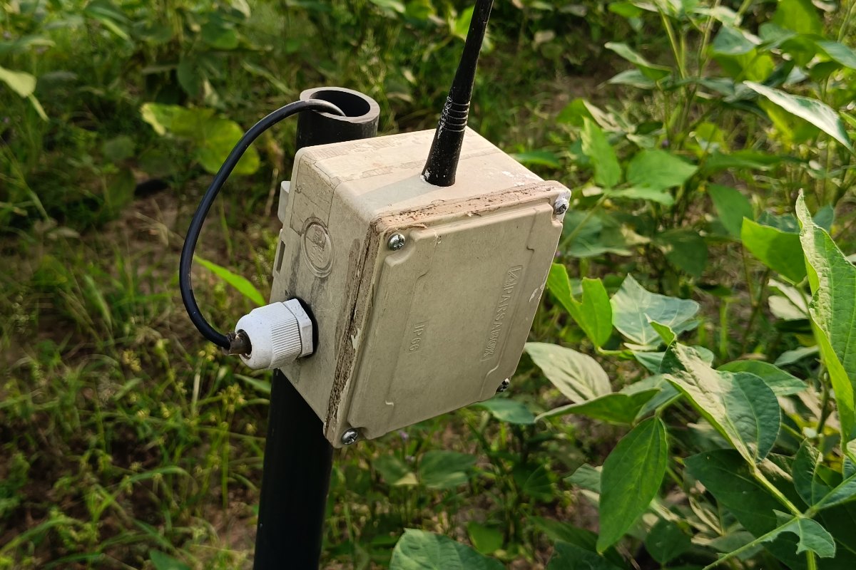
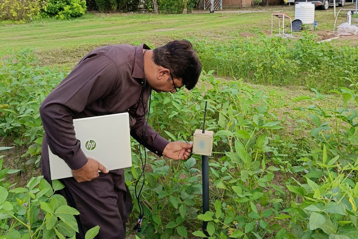
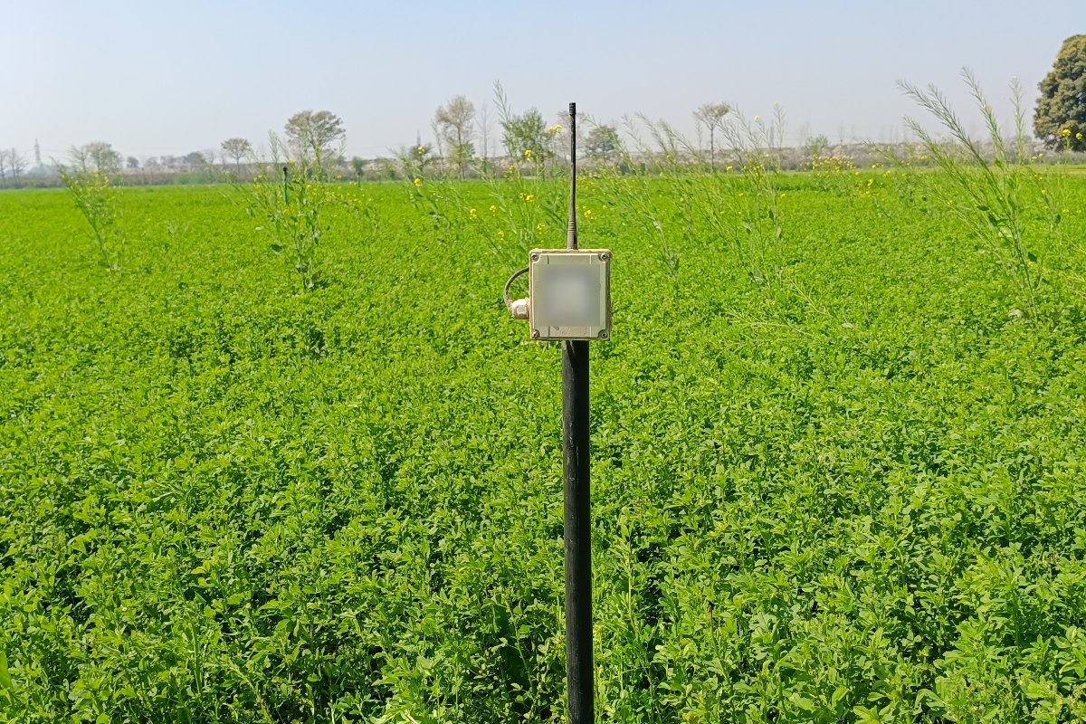
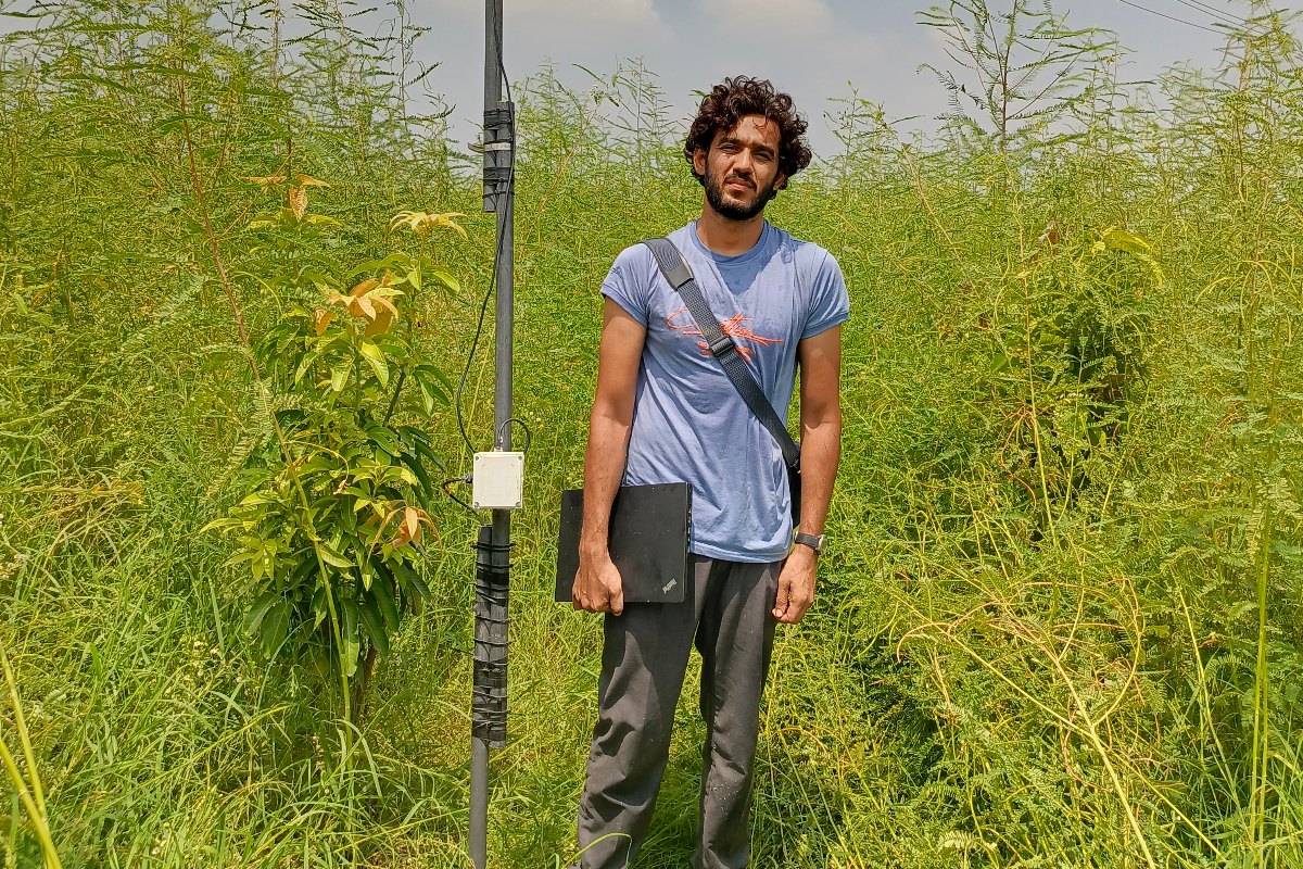
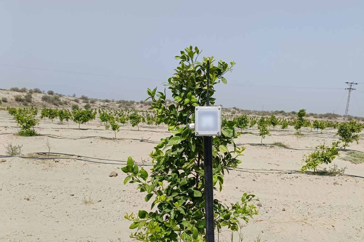
North and South PunjabScope: Soil moisture monitoring across 19 farms in Punjab. xWIT operates and maintains the installed WaterSense sensor network to a 90 to 100 percent uptime target. The service includes quarterly site visits and per farm reporting on a structured cycle.
Delivered: WaterSense soil moisture sensor network with GSM and LoRa telemetry, mobile dashboard, automated irrigation alerts and a maintenance retainer.
FAO Pakistan
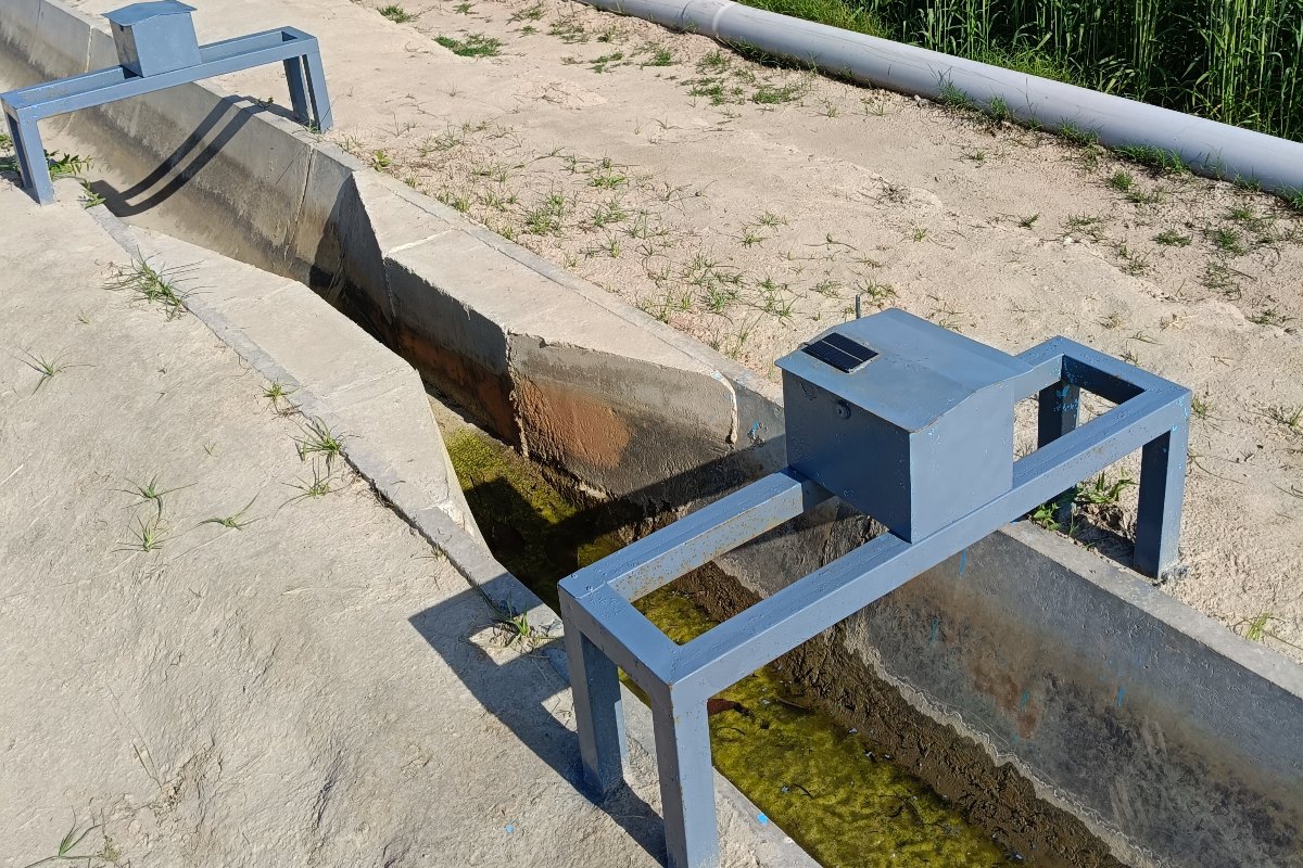
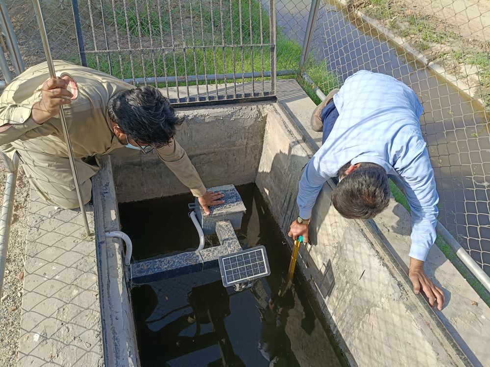
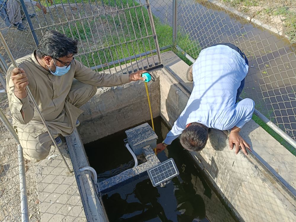
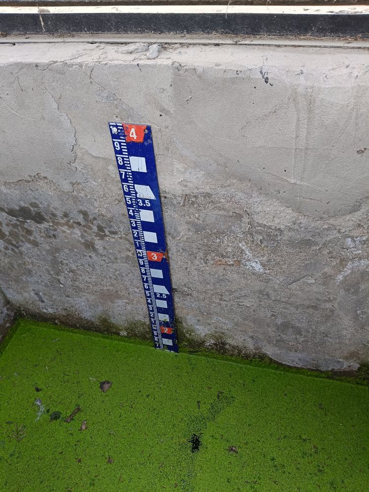
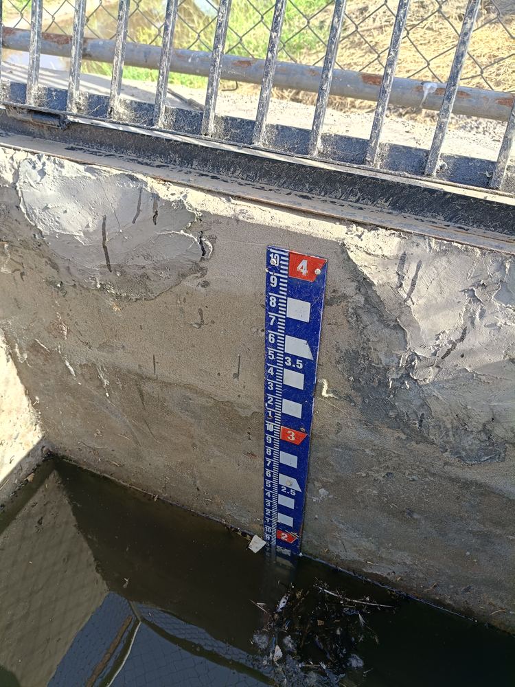
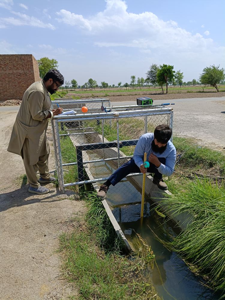
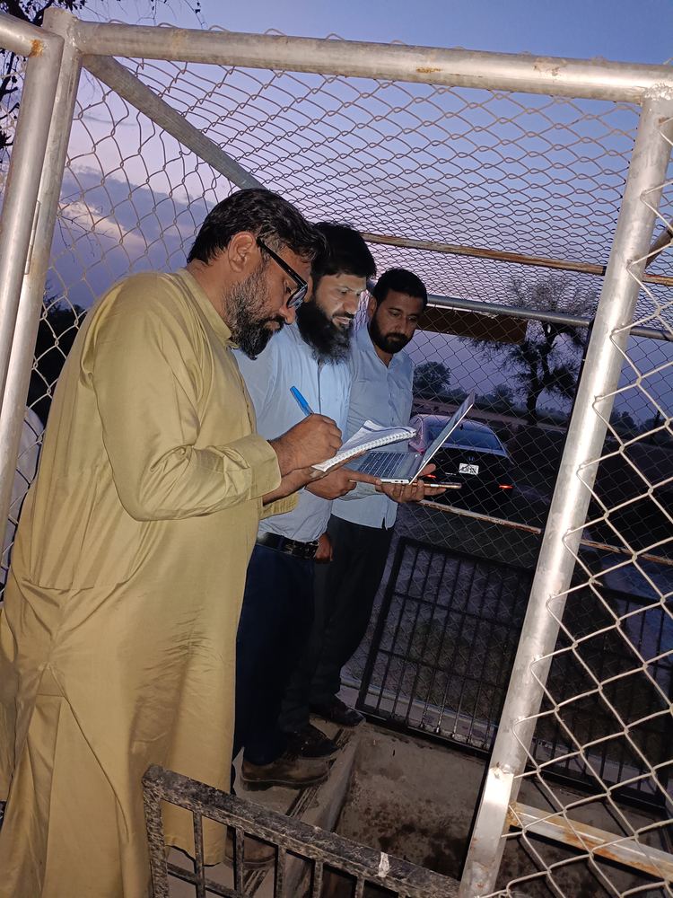
Khanewal, Punjab and Sanghar, SindhWater level monitoring on minor canals and watercourses under the FAO programme GCP/146/PAK/GCF, delivered across two provinces. xWIT supplied and bench tested the instruments, built the gauge wells, installed and commissioned the network, set up the data portal, and trained the operators who run it. One accountable party from civil works through to handover.
Khanewal, Punjab
- Water level instruments for minor canals and watercourses, bench and field tested before deployment
- Gauge well material and civil works at three sites
- Installation and commissioning of five canal gauges on minor canals
- Live data portal for the sensor network
- Operator training on watercourse level sensors
- Ten scheduled follow up maintenance visits
Sanghar, Sindh
- Water level sensors and field hardware for watercourses
- Installation and commissioning on minor canals
- Data portal for the watercourse sensor network
- Flow sensor procurement
- Operator training on watercourse level sensors
- Eight scheduled follow up maintenance visits
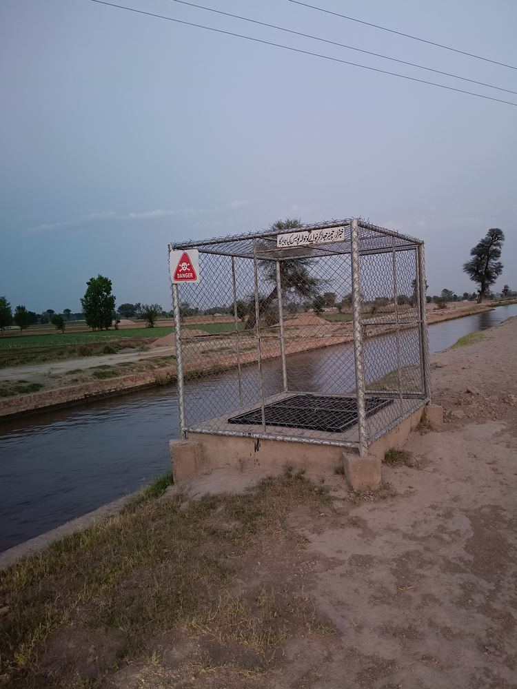
Three gauge wells in Khanewal were rebuilt so that the instrument holds a reading across the full range of canal flow. Well height was raised by 1.5 feet. The two 4 inch pipes were replaced with 5 inch concrete pipes and a third pipe was added so the well reaches full supply level. A silt pocket of 6 to 8 inches was formed at the base to keep sediment clear of the sensor.
Who We Serve
Four kinds of organisation, each with a different reason for needing independent measurement.
Enterprises
Industry, energy and agribusiness managing water dependency or environmental liability. Textile mills, sugar mills, food processors, pharmaceutical manufacturers and energy producers who discharge into waterways or draw from canal and groundwater systems. The usual drivers are NEQS compliance, ESG reporting, supply chain water risk and export certification.
Government
Ministries, irrigation departments, utilities and provincial environment agencies that need measurement they can defend. Independent data carries weight in allocation disputes, enforcement and public reporting precisely because it does not come from an interested party.
Multilaterals and Development Funders
Development banks and programme funders that require independent measurement and verification. Our work with FAO in Khanewal is the reference. The requirement is usually data quality that stands up in a programme audit or a regulatory submission, backed by calibration records and a documented method.
NGOs and Implementing Organisations
Organisations that need rigorous evidence for donor reporting and monitoring frameworks. Water quality surveillance and soil sensor deployments produce numbers that can be cited in a published report, with the calibration trail to support them.
Engagement Models
Three ways to work with xWIT.
Study
A defined question answered once, with a report and dataset delivered. Scoped, priced and delivered as a fixed output, with no ongoing obligation on either side.
Project
Design and build of a monitoring or modelling system, handed over on completion. xWIT designs, builds, installs, calibrates and hands over with operator training. You then run it.
Retainer
xWIT operates the system, maintains calibration and reports on your cycle. You receive data and reports. We carry responsibility for uptime. The Nestle Pakistan deployment runs on this model.
Discovery
Map the decision, the data that already exists, and the gap. Our engineers ask what the data will be used for and where the gaps are. The output is a scope with enough specificity to price against.
Design
Network layout, model selection and reporting format agreed before anything is bought. Instrument type, count, placement, telemetry configuration and reporting cycle are settled with you before procurement begins. No surprises on delivery.
Build
Instruments installed and calibrated, models validated, dashboards live on real data. Assembly and calibration happen in our instrumentation workshop and installation is handled by our field survey unit. Dashboards go live on actual site data, not demonstration data.
Monitor
Ongoing operation and reporting, with a defined handover path to your team. On a retainer we operate and report. On a project a structured handover with operator training closes the work. Raw data and calibration logs are handed over in full.
Tell us what you need to measure.
Send the requirement in a paragraph and we will come back with a scope, a timeline and a cost.